Bintel_Logo_Linear_Red and White_72.png
  • Home
  • Industries
    • Aerospace and Defense
    • Geospatial
    • Government
    • Training and Education
  • Solutions
    • Bintel Maps
    • Bintel CWPP Services
    • Bintel Space
    • Bintel Sustainability
    • Audience Insights
    • Talent Analytics
    • Trust Builder
    • Custom Solutions
  • Platform
  • About Us
    • History
    • Core Values
    • Our Partners
    • Meet the Team
  • Contact
    • Contact Us
    • Careers
    • Partner
  • Schedule Demo
  • Blog
    • Subscribe
OSINT 4

Bintel Maps

Do you love maps? | Do you use maps? | Do you want to build and share maps?

If so, Bintel Maps is for you, whether you work solo or run a large team with assets all over the world. No professional GIS training or additional software required. SCHEDULE DEMO


We can help you build your first map this afternoon using data sources curated by others in our public "Discovery" repository.

Whether the data is cultural, natural, recreational, private, or public, you can quickly build and share beautiful maps. Serious users with critical operational requirements have not been compromised. Bintel Maps addresses the day-to-day tasks of information collection, management, and reporting. Features include scalability, flexibility, interoperability, ease-of-use, and audit-ability. Discover risks and opportunities hidden in the vast amounts of public data.

Visit the Discovery Page to Browse Our User's Public Maps. Go to Bintel Maps!

The best way to see how easy and powerful this application can be is to bring us a problem and we'll show you what data can be found and map it. Private data like customer files, no problem, any file can be kept private. We can help with geocoding and data cleaning or API integration for enterprises with real time needs. Here's how it works:

1.  Find the data you need

2.  Import data and create a Trust

3.  Create a Bintel Map and add a Source (from your Trust or from a Public Trust)

4.  Create and style the Layer to communicate your message

5.  Add cool features like 3D and Terrain, then publish

Visit the Discovery Page to Browse Our User's Public Maps. Go to Bintel Maps!

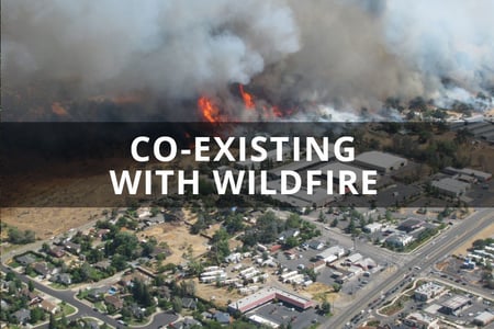
Some examples of our maps for wildfire planning are shown below:


BINTEL MAPS

Boulder County CWPP 2013
Boulder County - Heatmap of Addresses with recommended CWPP Projects in 2013
Pitkin County Basemap
Pitkin County - Roads, Mining Sites, Federal Lands, Open Space, Scenic Areas
Routt County(1)
Routt County - Contours, Roads, and Parcels in Steamboat Springs, CO
Routt County
Routt County - Open Source Data for the County and Steamboat Springs including parcels, contours, geologic hazards, municipalities, air quality, and more
Bintel Maps Homepage
Education_Outreach  

Planning_Coordination

EDUCATION & OUTREACH

Bintel Maps is a powerful application to collect, map, maintain and distribute geospatial information like that required by state and local wildfire teams. Storymaps, web applications, mobile applications, reports, and custom interfaces available. With Bintel Maps, users can quickly collaborate and share their data to stakeholders, partners, and constituents.


PLANNING & COORDINATION

Bintel Maps creates a common reference for distributed data, events, and organizations. Consolidated information can be used to plan, monitor, and report on projects that involve multiple jurisdictions. Data provenance and authenticity are traced and verified. Our system accommodates a wide range of data types, mitigating the challenge of interoperability.

Risk_Assessment_Identification   Operations_Management

RISK ASSESSMENT & IDENTIFICATION

Bintel Maps provide risk managers a tool to display the output of their activities that is seamlessly integrated with other functional areas. Bintel Maps support the risk manager’s ability to track serial changes, set alerts, and create routine reporting frequency.The net result is improved visibility, more complete perspective, and better decision making.


OPERATIONS & MANAGEMENT

Resource planning and protection activities require the collection of large amounts of data and information from myriad sources. The effort to acquire and aggregate this content is a tremendous asset that can be leveraged by teams carrying out incident operations. Bintel Maps collaboration features unlock critical data from silo to maximize the return on the cost and efforts associated with its creation. 


Advanced features
The benefits of integrating Bintel Maps with operational intelligence platforms helps incident commanders and operations with mobile updates but also enables incident data to be leveraged by support partners like public relations officers and evacuation teams. Capturing event-stream data allows non-operating entities to have access to the most current and updated information sources available. Bintel Maps breaks down the walls between how, where, and by whom data is collected and sourced. Talk to us if you need more or have questions. 

Bintel Maps doesn't replace any of the professionals or tools you rely on today, it makes them better.


For more information on Bintel Maps and our thinking behind it, check out our blog posts:


August 18, 2023

Co-Existing with Wildfire

Three of the largest fires in Colorado history have all occurred since 2020, with the most destructive fire, Marshall Fire, destroying more than 1,000 structures.

December 30, 2021 was a day that I will never forget, as this was the start of the Marshall Fire. I currently reside in Superior, Colorado where this fire ravaged and incinerated our community, as well as our neighboring city of Louisville, both located in Boulder County, Colorado. I had just returned home from Arizona after the holidays .... read more.


August 11, 2023 Communication-Drives-Collaboration-and-Implementation

Communication Drives Collaboration and Implementation 

Brilliant minds working on the Wildland-urban interface (WUI) are all around us. Sometimes we just need to look, ask, or get engaged. The challenges of wildfires are complex. Wildfire behavior combined with human behavior is super complex…. These two behaviors clash when it comes to evacuation. 

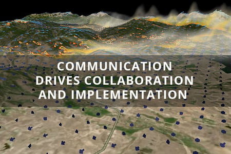
Katherine Conner, Chris Dyal, and I attended a great presentation and discussion last week at NCAR, our National Center for Atmospheric Research in Boulder, CO. The topic was Leaving it all behind: Evacuation lessons from wildfires in Colorado. I highly recommend watching the video .... read more.


August 4, 2023Fostering-Collaboration-for-the-CWPP-Process

Fostering Collaboration for the CWPP Process

Earlier this year Bintel, Inc. was selected by Eagle County Colorado to help modernize their Community Wildfire Protection Plans (CWPP). Some of the largest problems they faced included collecting various types of files, collaborating on maps, and keeping the public up to date (more often than every ten years). We first talked about this in In the West It’s Always Wildfire Season and Time to Update Your CWPP .

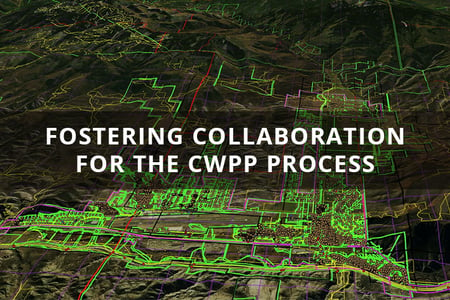
Working together, we have developed a mapping tool that is designed specifically for the State of Colorado and its counties. The tool accepts most geospatial file types making it easy to collect and view the files .... read more.


 June 16, 2023In the West It’s Always Wildfire Season and Time to Update Your CWPP

In the West It’s Always Wildfire Season and Time to Update Your CWPP

Canada might have the headlines today but preparation for wildfires never stops in the West. Natural resource managers and wildfire professionals manage a wide spectrum of stakeholders, a maze of jurisdictional and funding alternatives and a vast area of mother nature. It’s time they get their own intelligence platform to collect, analyze, display and publish wildfire information .... read more.


SCHEDULE DEMOBintel Maps Pricing


Share on facebook Share on linkedin Share on twitter
1155 Maple Circle, Broomfield Colorado contact@bintel.io
Copyright 2025