30 Day Map Challenge Day 14: Europe

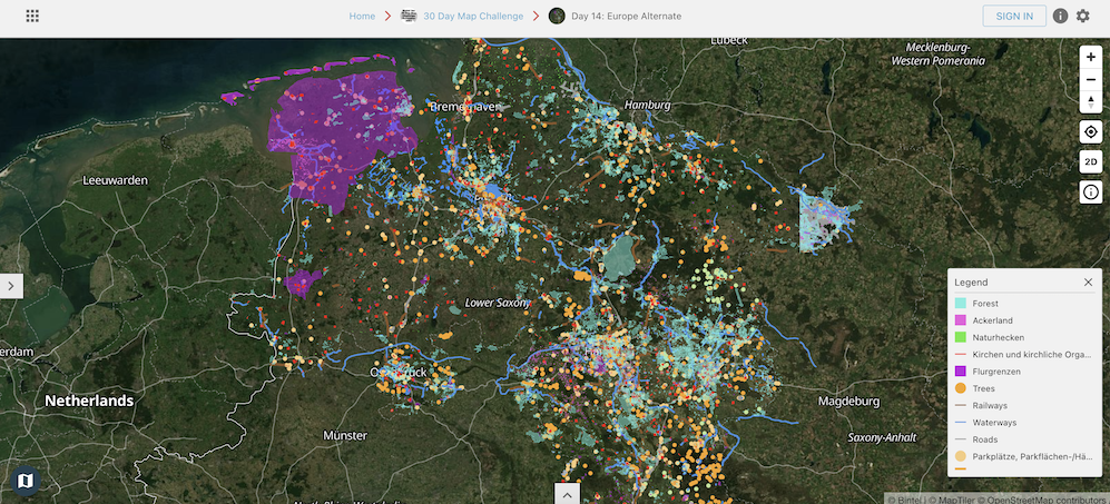
Map Title: Deep Dive Into Open Data for Niedersaxen Deutschland

Creator: Tom Marsh, assist Walt Diggelmann SUI

Link to the Interactive Map: https://maps.bintel.io/o/30daymapchallenge/maps/Day_14_Europe_Alternate/view

Map Description:  This map was inspired by work with a customer in the agriculture industry that needed to understand customer context in each region with greater depth.  The goal is more precise delivery of industry intelligence and new research.  This map has a lot of data.  While the overview is colorful, the analysis really comes alive when zoomed in to a farm, residence or urban areas. 

Niedersaxon Image

Niedersaxon, Germany

maps.bintel.io
Land Use in Bremen, Germany
maps.bintel.io
Downtown Bremen, Germany
maps.bintel.io
Irrigated Farmland in Bremen, Germany

This map contains data from:

    • Niedersaxon Open Data Site
    • Germany Open Data Site

Click here to learn more ab\ how people are using Bintel Maps to participate in the 30 Day Map Challenge.

For the daily challenges go to https://30daymapchallenge.com/

Topics: Mapping, Geospatial, Bintel Mapping Tool, 30DayMapChallenge, geography, gis

Tom Marsh

Written by Tom Marsh

Tom has served as CEO of Bintel since cofounding the company in 2019. Before that he was COO of ai-one inc. where led the projects for NASA Marshall, SwissRe, Boeing and FedEx. For the past 15 years he has specialized in artificial intelligence applications for enterprise and government with a critical integration of Subject Matter Experts, AI, data, and visualizations. For FedEx this included topic classification and visualization of customer experience data collected weekly from survey data on FedEx.com. A project with an Army military intelligence group involved the development of a sophisticated intelligence platform that included GEOINT and provided situational awareness for an allied military. His current mission is to bring that caliber of solutions to counties in the West.