Bintel and Fire Adaptive Solutions Team to Develop New and Upgrade Existing CWPPs
We are pleased to introduce our new collaboration with Marc McDonald and Fire Adaptive Solutions (FAS). FAS's McDonald is one the most experienced experts in the country in Community Wildfire Protection Plans (CWPP). FAS is the latest to join our wildfire team with FirePoint Forestry and Athena Intelligence to help reduce the West's backlog of new and outdated CWPPs.
Under both Anchor Point Group and Fire Adaptive Solutions, Marc McDonald has been writing CWPPs throughout the western US for over 20 years. FAS specializes in wildfire hazard analysis and mitigation planning focused on Wildland Urban Interface (WUI) and Wildland Intermix (WI) communities. The company principals are all former or current wildland firefighters with experience on campaign wildfires (NWCG Type 1 and Type 2 Incidents). They are focused on hazard analysis and recommendations designed to mitigate wildfire threats to life safely, residential development and critical infrastructure.
The FAS team developed and updated CWPPs and Incident Response Plans under Anchor Point Group from 2003 to 2021. In 2021, Anchor Point was acquired by Precisely, who discontinued CWPP consulting services. Since then, the FAS core team of experts have continued developing and updating CWPPs under Marc's leadership as Fire Adaptive Solutions, LLC.
The Bintel Team's mission is to combine geospatial intelligence, wildfire behavior, mitigation and the latest AI powered fire probability analytics to accelerate the delivery and lower the cost of CWPP and WMP projects. Read more...
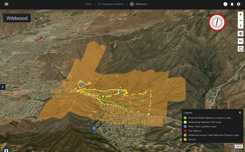
Bintel’s "Living CWPP" incorporates CSFS standards and USFS Wildfire Hazard Potential maps (WHP). The report services are needed for grant funding applications to reduce the huge backlog in mitigation projects. More than a better map, we provide a collaborative platform that fuses geospatial data and can deploy straight from the planning team to the field.
Increasingly, cities, counties and watersheds are using the Bintel Team to share mitigation plans and other geospatial intelligence, both internally and with the public. With our solution, you can leverage these initiatives and the public data they generate.
Follow us to stay abreast of our developments or request a conversation today with Marc to discuss options for updating your plans.


