Bintel Maps Series - Using the Collaboration Features
Our maps application was built with three key priorities in mind: convenience, collaboration and communication. First, make it easy for non-GIS professionals to use. Second, support teams. both within and across organizations to leverage their work. Third, build it to facilitate distribution/communication to our users intended audience.
Working with wildfire professionals in Colorado, we found multiple overlapping efforts updating CWPP documents. Each jurisdiction creating the data and maps they need without realizing that others in their jurisdiction have already completed the same work. This is especially costly when taxpayers in small, less wealthy areas pay consultants for duplicate work, instead of sharing the data and maps on a collaborative platform. Additionally, completing work within the strict boundaries of a city, county, fire district or HOA, ignores the fact that fires don't respect jurisdictional boundaries. Great work by one team can be nullified by an adjacent group that doesn't have the same resources.
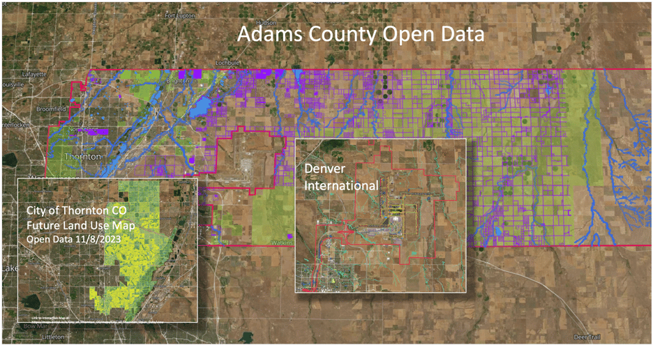
A simple example demonstrates our approach to addressing these issues. Using our application I'll show how Adams County, the City of Thornton and the Denver International Airport could work together to create better planning and situational awareness than each on its own. In this case, open data from Adams County provided a base layer, the City of Thornton for more local detail and the Denver International Airport map filled in the Adams County missing puzzle piece.
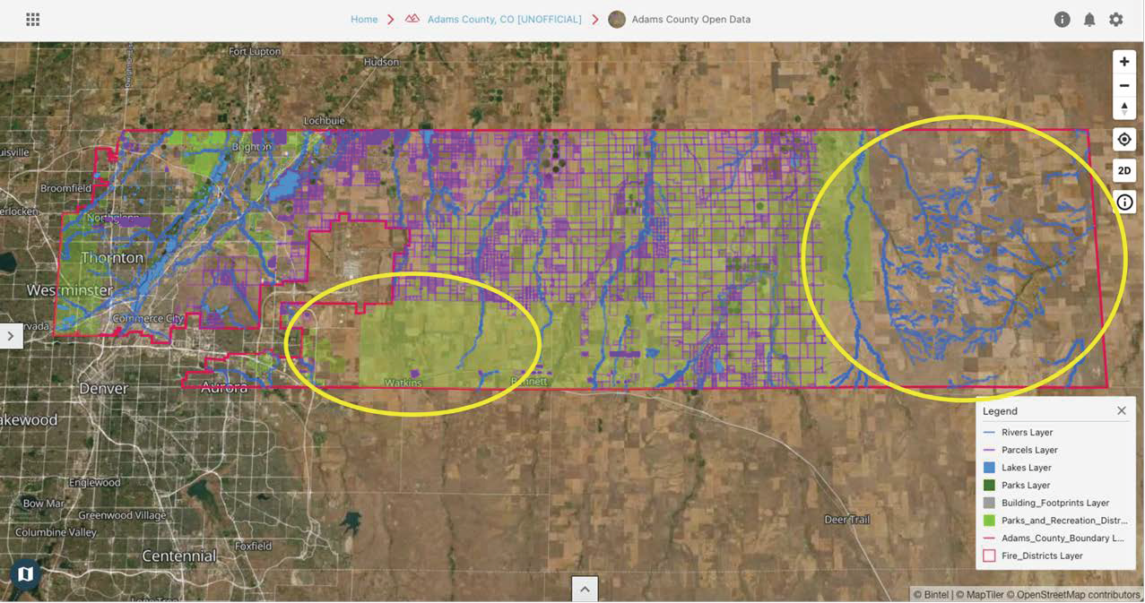
Adams County - The first layer of data in the map below is from Adam County's website. The green areas provide land use descriptions, blue for rivers, lakes and reservoirs with grey for building structures and purple boundaries for parcel information. Without mapping this data you might miss the gap (circled in yellow) in east county and again in the section just south of DIA. While you can find the data at https://data-adcogov.opendata.arcgis.com/ , users of our solution will find it easier to use data from the Adams County Trust already on the platform.
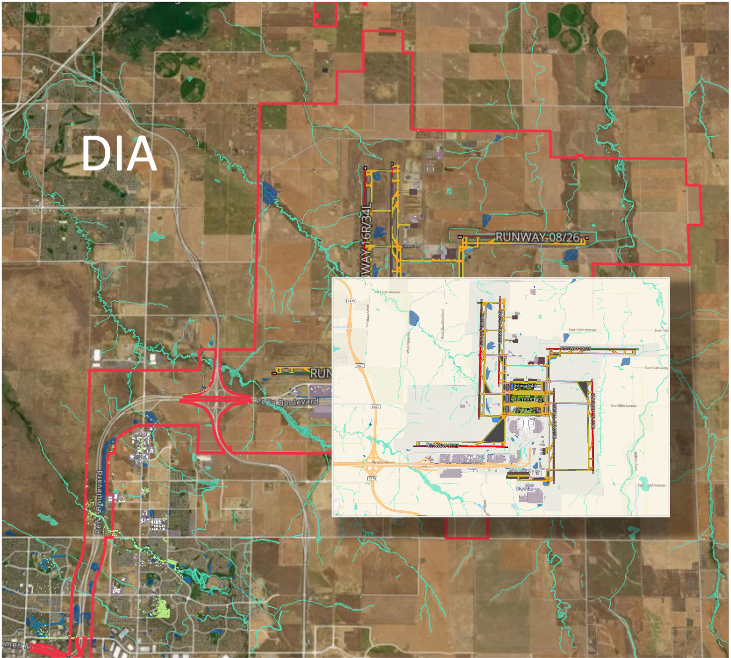
Denver International Airport (DIA) - the odd puzzle piece representing DIA has no data on the Adams County website so if you live on the edges of that property, you'll need to find the data (also available on our site). Below is a DIA map providing insight into the property as well as the facility, buildings, runways, parking and transportation features.
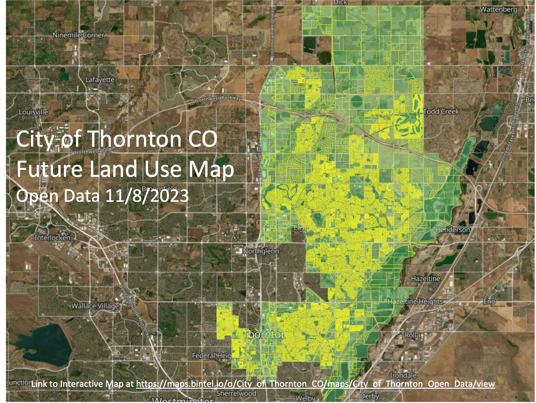
City of Thornton - Finally taking advantage of the great data on the City of Thornton site, the gaps in detail from Adams County can be filled out with a layer built with data from each city or other jurisdictions that supply local information. As you zoom into the map, the local detail can be used to provide better analytics. This became apparent when zooming into a Thornton neighborhood, there we many buildings in the satellite imagery that did not have building footprint data (in the Adams data).
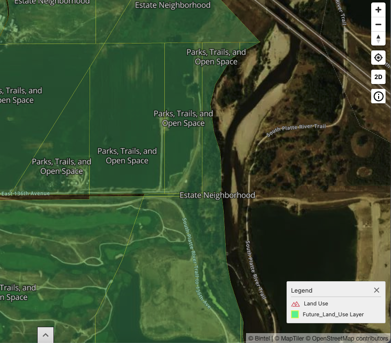
These gaps were filled with the Thornton data, and answered were questions around land use planning along the South Platte as you can see below. The maps can be published, shared in social media, printed or shared as live links that can be navigated by the public.
The composite is shown below and this entire exercise was completed in a few hours, a great help to short staffed agencies that are mandated to develop and share the decisions and plans with the public.
Extending this effort to specific issues, specialized maps and situational awareness for emergency responders is more efficiently delivered enhancing everyone's productivity.
Ready to try it, request an account. We will setup your account, demo, train and build a map with you in an hour.
If you have some ideas you’d like to see mapped or better yet, would love to build your own, please follow us and try out Bintel Maps.