30 Day Map Challenge Day 2: Lines

Map Title: Hiking through Colorado

Cartographer: Devin Marsh

Link to the Interactive Map: https://maps.bintel.io/o/30daymapchallenge/maps/Day_2/view 

Map Description: There are many ways to travel - walking, biking, driving, and trains - but in Colorado hiking is one of our favorites.  This map is designed to show the trails we use to navigate through and enjoy the breathtaking scenery Colorado has to offer.


Web capture_3-11-2023_17367_maps.bintel.io

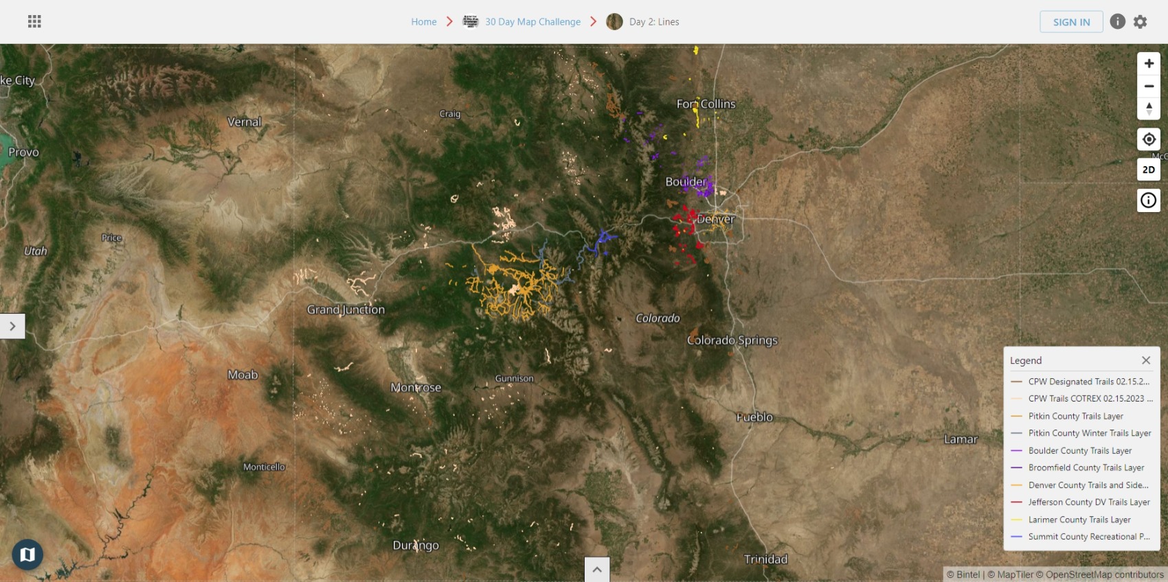
This map contains data from:

    • Colorado Parks & Wildlife
    • Boulder County
    • Broomfield County
    • Denver County
    • Jefferson County
    • Larimer County
    • Pitkin County
    • Summit County

Click here to learn more about how people are using Bintel Maps to participate in the 30 Day Map Challenge.

For the daily challenges go to https://30daymapchallenge.com/

Topics: Mapping, Geospatial, Bintel Mapping Tool, 30DayMapChallenge, geography, gis

Devin Marsh

Written by Devin Marsh

Devin is cofounder and Chief Operating Officer responsible for Bintel's product marketing management, operations and customer success. Working closely with all teams, she helps bring cohesion to the product, marketing, and sales efforts. She thrives in an ever changing role and work environment, starting her career in civil engineering and construction then shifting over to the tech industry where she uses her people skills to work with people of all different backgrounds and experiences. Her passion lies in using technology to help improve the health and safety of communities that may have little or no experience using advanced tools. Devin holds a BS in Civil Engineering from the University of Colorado Boulder.